|
BIM - Architectural Site Surveys
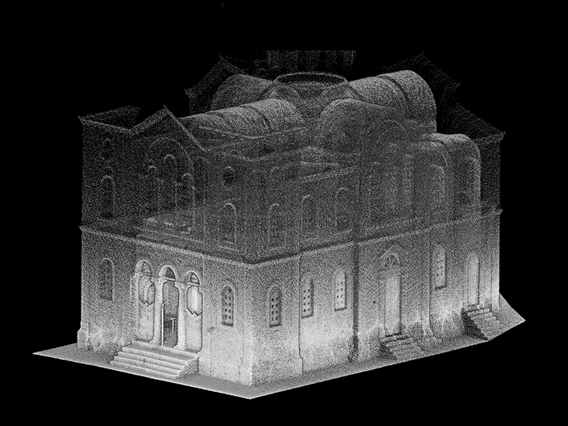
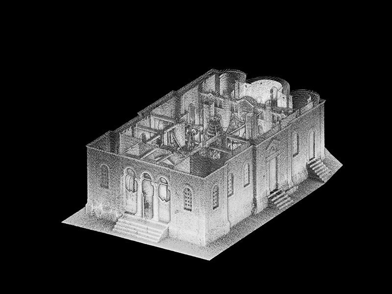
The latest advances in technology and equipment and particularly the use of 3D Laser Scanners and 3D Photogrammetry, allow us to get a better understanding of built space, obtain highly accurate measured data and simulate real environmental conditions to an extent that makes planning simpler, safer and far more productive.
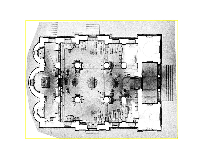
Being able to choose from traditional site surveying methods to more advanced 3D Surveying methods (such as 3D Laser Scanning and 3D Photogrammetry) we can apply the most suitable solution to every project. Using the right instrumentation that includes a terrestrial laser scanner, a portable handheld laser scanner, standard topographical equipment (Total Stations, GPS receivers) and Photographic equipment (Cameras, Drones) our goal is to minimize time and cost for every project and deliver datasets in any form that is demanded, such as :
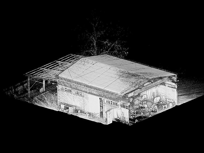
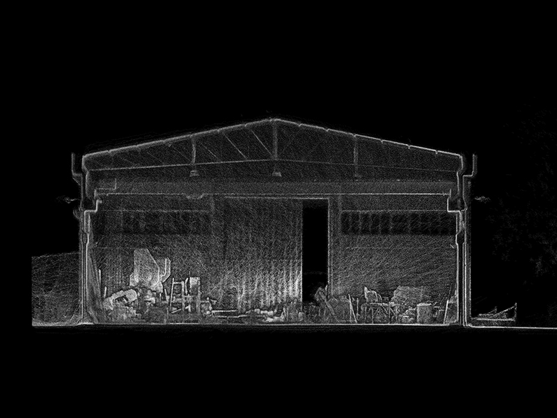
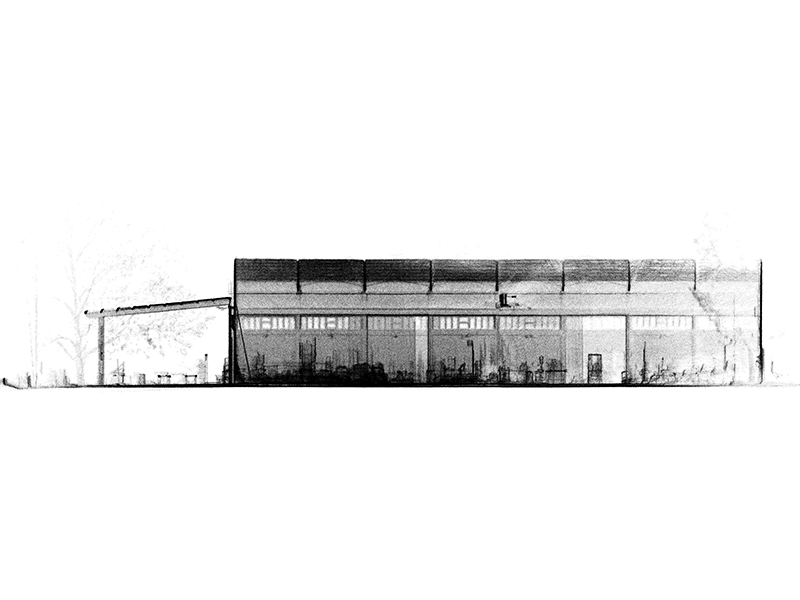
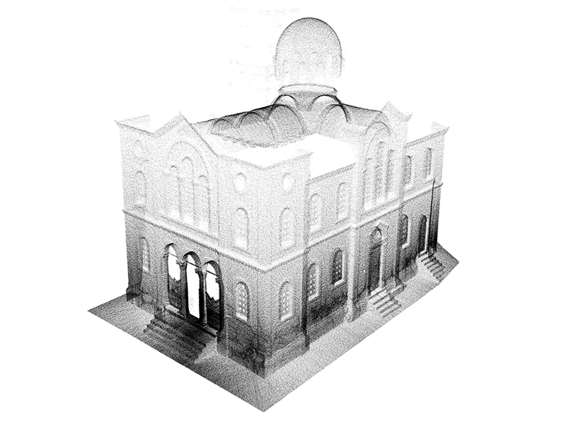
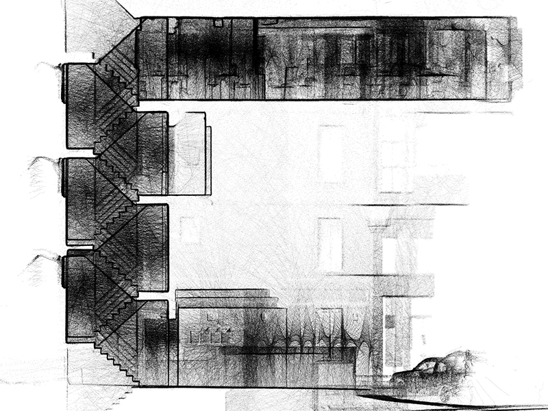
- 3D Raw Point Clouds
- 3D Edited Point Clouds and Models
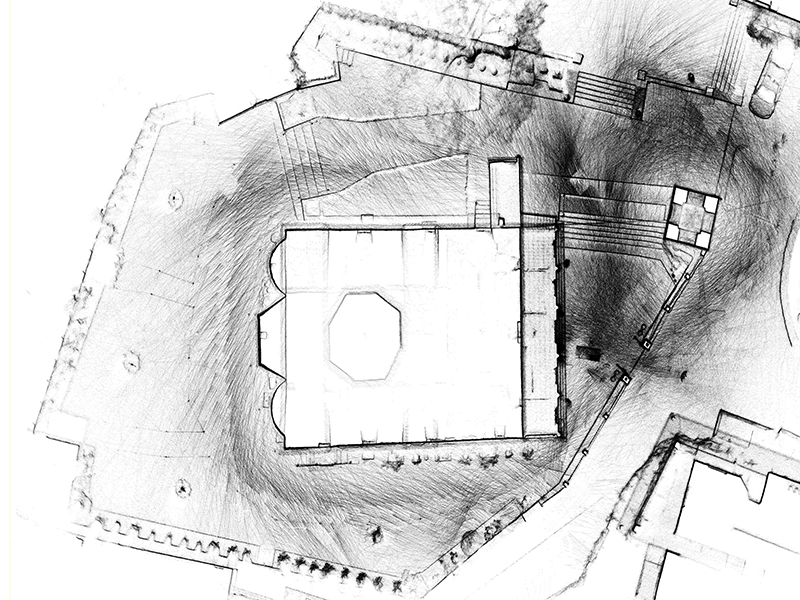
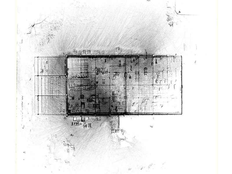
- As-Built Layouts
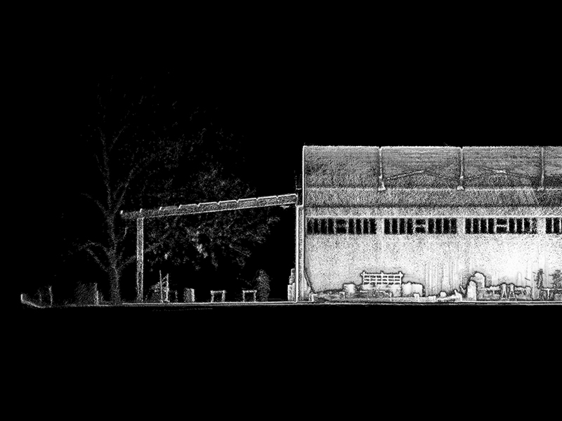
- Cross Sections and Elevations
- Visual Representation of Surveyed Sites
The choice of equipment and our past experience gives us the ability to work even at the most demanding sites like large buildings with complex interiors. Our services can benefit activities such as:
- Construction Planning and Monitoring
- As-Built Surveying
- Building Maintenance and Renovation
- Heritage Buildings Recording
- Rapid Interior Scanning
- Facades Inspection and Digital Orthophoto
- Modeling Built Environment
|